
Monday, June 12th to Wednesday, June 14th
This Blog post will encompass three days worth of travel. Because well… It seems like one long day. So here we are with one big post.
The approaching storms that, on the radar, looked like they might enter our area overnight never amounted to much. However to borrow, and slightly modify, an old pilot’s saying: It’s better to be here in the harbor wishing we were out there, than out there wishing we were here.
We were up at 5:00 am to leave our pond of refuge near the town of Skanee MI. Making our way out the shallow channel was a bit easier because today’s clearer and calmer waters provided a view of channel bottom from my perch on the bow. With a few hand signals directing Chad, we were able to traverse the deepest part of the channel and start motoring the calm waters of Huron Bay.
Cruising along about a mile offshore the mosquito population in the cockpit area seemed to be growing, No way did we bring these with us from the harbor. Soon there is a rather large swarm is following the boat, with most making it aboard for a free ride. I jokingly tell Chad that; bug spray was the last thing I thought to bring a boat trip. The swatting and smacking these little biters became maddening as the swarm grew. I mention that just a slight breeze would be helpful, to blow them away from the boat.
Inspired by my assessment, and reaching a wit’s end, Chad goes below and shortly re-emerges with what he hopes is the solution to our misery… A battery powered, pint-sized leaf blower that Chad brought along to quickly inflate the dingy. Waving the blower at the swarm and taking aim on the individual dive-bombers, Chad is able to send many flying into parts well beyond the zone of the boat. Even pointing the high-powered blast of air at the many that lighted on the boat. May seem long shot not to mention extremely time-consuming to shoot mosquitos with a leaf blower that may very well return moments later, but were on a sailboat traveling at the rather moronic pace of six knots. There is not much else to do for entertainment? And it seems to be working.
Took us nearly three hours to make it to the point at which we turned around yesterday. Lady Superior has a much calmer demeanor today giving us shallow swells that gently rock the boat as we motor along eastward. Just like our first day, a fog has enclosed around us with the same constant conflict between closing in tight, only providing just a few feet of visibility, to opening up to giving us a glimpse of the distant horizon and land. One difference over first day’s fog is an ever-present sun shining on us.
Presented with a decision of how far to travel today we weigh our options. Looking at the charts there are just a few opportunities on the Michigan shore of Lake Superior shore to get fuel and tie in for the night. After some deliberation, looking at all the options available, as well as double and triple checking the weather at multiple sources, we decide to keep motoring throughout the night, making one quick stop for fuel.
Just a little after noon we pulled into the city marina in Marquette MI to take on eighteen gallons of diesel fuel. With no restaurants within an easy walking distance of the Marina we decide to make lunch on the boat and continue motoring eastward. Lady Superior continues to show mercy on us as the surface of the lake remains just low and gentle rolling swells.

Freighter getting loaded with Iron ore in Marquette MI
As early evening approaches I’m the first one to declare that sleep sounds like a good option right now, so I head below to get tenderly rocked to sleep. After a couple of hours, I reemerged from the cabin and noticed a sunset was missed as the sky is still ablaze with varying vibrant hues of orange. Asking Chad if it was a good sunset he smiles and describes how the clouds bisected the sun giving it an appearance of shining through a set of blinds. I was ok with missing this sunset for Chad, being well aware that it can be good for the soul to spend such moments alone, allowing one to reflect and give thanks.
As darkness consumes the lake, flashing beacons many miles in the distance from radio towers as well as marine markers placed near shore become very clear. The marine markers can tell a boater much. By identifying the color and counting the number of seconds between each flash, that information is cross-referenced with a nautical chart telling which harbor, channel, point or obstacle to be avoided resides there.
The darkness also revealed a light show beyond the Michigan shore. A thunderstorm taking place over a hundred miles away to the south. Having learned our lesson the previous day we checked the weather forecast, again with multiple sources. Live radar, weather channel.com, weather underground, and even the National Weather Service automated radio broadcast all indicate we’re in for good weather. I sooo hope they are right.
Soon its Chads turn to go below for a little rest. Bundled up in every layer I brought along the night air on the big lake has quite a chill tonight. Keeping a heading on the GPS that will eventually put us at the tip of Whitefish Point, requires an occasional bump of the wheel to maintain the heading. I keep myself occupied with the local radio and singing along to songs I haven’t heard in a long time. Maintaining the radio as we trek along the lake is quite easy as it takes awhile to travel out of broadcasting range. I have however come to the conclusion that radio stations in the Upper Peninsula are not allowed to play music newer than 1979.
Unsure how long Chad had intended to sleep but at 3:00 am he will have been asleep for nearly three hours. In another twenty minutes, I’m going to wake him up because it’s becoming very difficult for me to keep my eyes open and I’m quite chilled. That thought no more than when through my mind when Chad appeared from below. Gave him the quick synopsis of where we were, what navigation lights I have identified, then headed below myself.
When I woke after sleeping about the same amount of time that Chad had, discovered I missed the sunrise too. The boat was just rounding Whitefish Point and our expected arrival at the Soo Locks at midday was looking to play out just as we hoped. Conditions on the lake were just about the same as when I went to bed, gentle winds out of the east and near calm waves. The light show that provided a spectacle of flashes on the horizon during my watch dissipated and never threatened our position on the lake.
Traveling the St. Mary’s River to the Soo was about as uneventful as the previous 30ish hours since leaving the protected harbors the previous day. The River is well-marked to keep any craft with a draft deeper than a few feet in safe waters.
With the Sault Ste. Marie Bridge to Canada in sight Chad radioed the Lockmaster to notify him of our pending arrival and most importantly to get instructions for negotiating the locks. The reply asked if we wished to go through the Canadian or U.S. locks. After responding that our preference was to use the U.S., instructions for using the lock was very simple. Simple to the point of downplaying the fact that 1,000-foot ships carrying ton’s of ore also use this same system, just as we used the same lake to get here. We much expected, as small pleasure craft, to be put on secondary status behind a line of freighters needing to make the transition. That, however, was far from the case as the only other users of the locks at the time were tour boats.

Sault Ste. Marie Bridge to Canada
Motoring up to the locks it’s pretty apparent they were not busy today. Right in front of the public viewing stands a lock attendant waited. Pulling up to his position he asked if we wanted lines, which means a rope to keep us against the wall the of the lock. Chad and I each threaded lines through cleats at the bow and stern of the boat so we could easily pay out line as we descended in the lock. Holding a conversation with the lock attendant we started about a foot or two taller than him and soon we were both at eye level, then he’s looking down at us, pretty soon we’re looking straight up a wall to continue the conversation.

Approaching the locks

Inside the lock at Lake Superior height

Twenty-One Feet lower
It took us eight minutes to drop twenty-one feet from Lake superior level to Lake Huron level. Darn close to 12:00 noon, the lower end of the locks opened and we motored out in search of the Sault Harbor for one more fuel stop.

A look back at the locks
After arriving at the harbor with fuel tank is topped and freshwater tank filled, we borrowed bikes available at the harbor to go find some lunch. Sitting in the diner it suddenly hit Chad and me at the same time, we were not feeling well. The lack of motion from being on the boat was giving us both an uneasy feeling. Yes, we had a LACK of motion sickness. Laughing at our predicament and how the diner felt like it was moving, we figured lunch was going to be a good or a bad idea. Getting back on the bikes to ride to the harbor the uneasy feeling went away, but all the same, I just wanted to get back on the boat.
Soon we’re back in what has become our element, motoring down the lower part St. Marys River toward Lake Huron. While traveling down the river twice we were overtaken by traffic traveling a bit faster than us. The first being a cruise ship, with people sitting in lounge chairs taking in the sights, waving to us as they passed. The second, being a freighter that traveled as it would rather run us down than lose a second of travel time. As the daylight slipped away again we had a decision to make, where to stop? At the very least our destination was the harbor in Detour MI and it was coming up soon. Review of the weather showed a very high probability we will have to forego sailing tomorrow. Figured it would be best to spend a day on shore in a place a bit more interesting than Detour, so the decision was made to cruise the additional six hours to Mackinaw Island, each of us taking turns at little bit of sleep on the last leg.

Getting passed by a Cruise ship on the St Mary’s
About three hours after turning the bow of the boat on a path towards Mackinaw Island on Lake Huron, the lights of the Mackinaw Bridge began coming into view. As it grew larger and larger by the hour, individual lights on the bridge became more distinct. The streetlights of the bridge appear as pearls on a necklace being held tight at its ends with the necklace adorned with a string of red jewels climbing to two separate points away from the pearls.
We pulled into Mackinaw Island Harbor at 3:00 am, forty-five hours after originally setting out from Skanee. Motoring in past the break wall, Chad is at the helm and I manning the bow with a bright light ready to distinguish what is what at the dock and find a suitable slip. Half way into the harbor I shine the light straight ahead to look for any buoys and directly in front of us about fifty yards a sailboat anchored out in the harbor unexpectedly popped out of the darkness. Taking action to avoid the other boat we easily get around and move towards one of the many empty slips available and tie off with extra lines because we know from the weather report we’re in for a little bit of wind.
I’m awaken around 8:00 am by the boat slapping against waves and one of the bumpers being squeezed between the boat and the dock with each swell. Each time the boat meets the bumper near the front cabin, it makes a squeak on the hull that was just too much to sleep through. I poked my head out the hatch to discover the winds had picked up pretty good and waves that are building just within the harbor are giving us our second roughest ride yet.

A view of Mackinaw Island Harbor. Chad’s boat is the one at the dock in the middle of the picture facing inland.
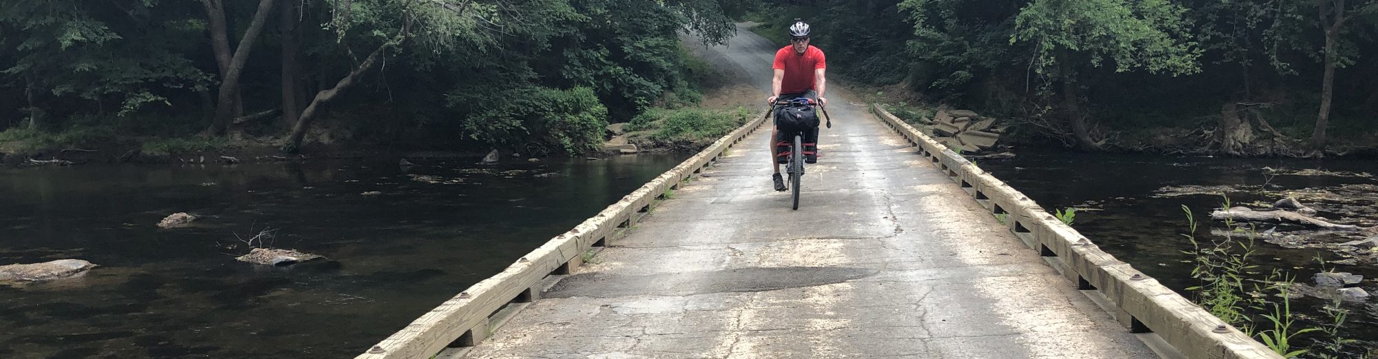
As predicted we will not be going anywhere today. Chad and I took advantage of just a couple of the many things to do on Mackinaw Island. This stop made bringing the bikes well worth it. Able to do a little exploring, seeing some things neither one of us knew existed on the island. So far the weather outlook for tomorrow on Lake Michigan is good. We’ll see in the morning.

It’s Lilac time on Mackinaw Island.
Thanks for sharing this adventure with us, Scott. So cool tobe able to follow yourjourney!